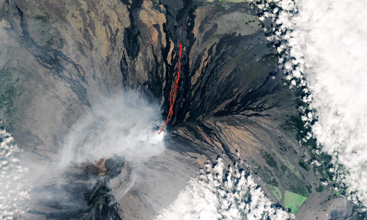
Natural-color Landsat 9 satellite image captured on December 2, 2022, of the ongoing eruption at Mauna Loa. (Click image for wider, high-resolution view.)
The Landsat 9 satellite acquired this image of the volcanic eruption as lava flowed past the Mauna Loa Observatory toward Saddle Road.
On December 2, 2022, this natural-color satellite image of an ongoing eruption at Mauna Loa was acquired by the Operational Land Imager-2 (OLI-2) on Landsat 9. At the time, lava from the Hawaiian volcano was moving north toward the Daniel K. Inouye Highway (Saddle Road). The image is overlaid with infrared data from OLI-2 showing the location of warm areas associated with lava.

Lava fountains along a fissure on Mauna Loa’s Northeast Rift Zone at approximately 9:30 a.m. HST on November 28, 2022. The photo was taken looking toward the north. Credit: USGS photo by K. Lynn.
NASA Earth Observatory image by Lauren Dauphin, using Landsat data from the U.S. Geological Survey.
Share your story or advertise with us: Whatsapp: +2347068606071 Email: info@newspotng.com


