From ice accumulation in the Washington, D.C. area to more than a foot of snow recorded Saturday in parts of Massachusetts, fall is beginning to look a lot like winter.
The first day of winter arrives Wednesday and it will be accompanied by bitter cold for much of the eastern two-thirds of the United States, federal forecasters said.
A cold air mass over Alaska and western Canada was expanding to the south and east Sunday through the holiday week, the National Weather Service said Saturday. Icy “upper-level energy” ahead of the mass has already triggered winter weather advisories for parts of Minnesota, Wisconsin and Michigan, forecasters said.
The cold high-pressure system will push temperatures 20 to 35 degrees below average in states including Nebraska, Montana, and the Dakotas. It will eventually impact the northern Rocky Mountains, the Midwest, the Northeast and areas in between, the National Weather Service said.
“The main weather theme coming up this week will be a massive arctic air mass that will affect much of the Lower 48 from the Northwest into the Eastern two-thirds of the U.S.,” the weather service said in a forecast discussion. “This frigid air mass will infiltrate the northern U.S. on Sunday.”
Thunderstorms and light snow could result for parts of the South, including the Mississippi Valley, as the icy air hits warm precipitation from the Gulf of Mexico, forecasters said.
The holiday week weather could also bring concerns about power outages and sufficient heating for some as communities along the Eastern Seaboard were still cleaning up after a powerful storm that brought snow and blackouts to the northeast this weekend.
In Maine, which was impacted by heavy snow, an estimated 65,000 customers remained without power late Saturday, Central Maine Power said in a statement. Restoring power could take until Monday or Tuesday because many roads were impassable and many utility lines were felled by trees and thwarted by branches.
In all, more than 144,000 utility customers from New York state to New England were blacked out by the storm, according to NBC News estimates.
In New Hampshire, where more than 25,000 customers remained without power Saturday night, state police recorded video of steady snow falling as brave motorists darted across Interstate 89 in New London.
Lake-effect snow, fueled in part by that upper-level energy, was recorded in western New York, particularly in Buffalo, and in other areas near Lake Erie and Lake Ontario on Saturday.
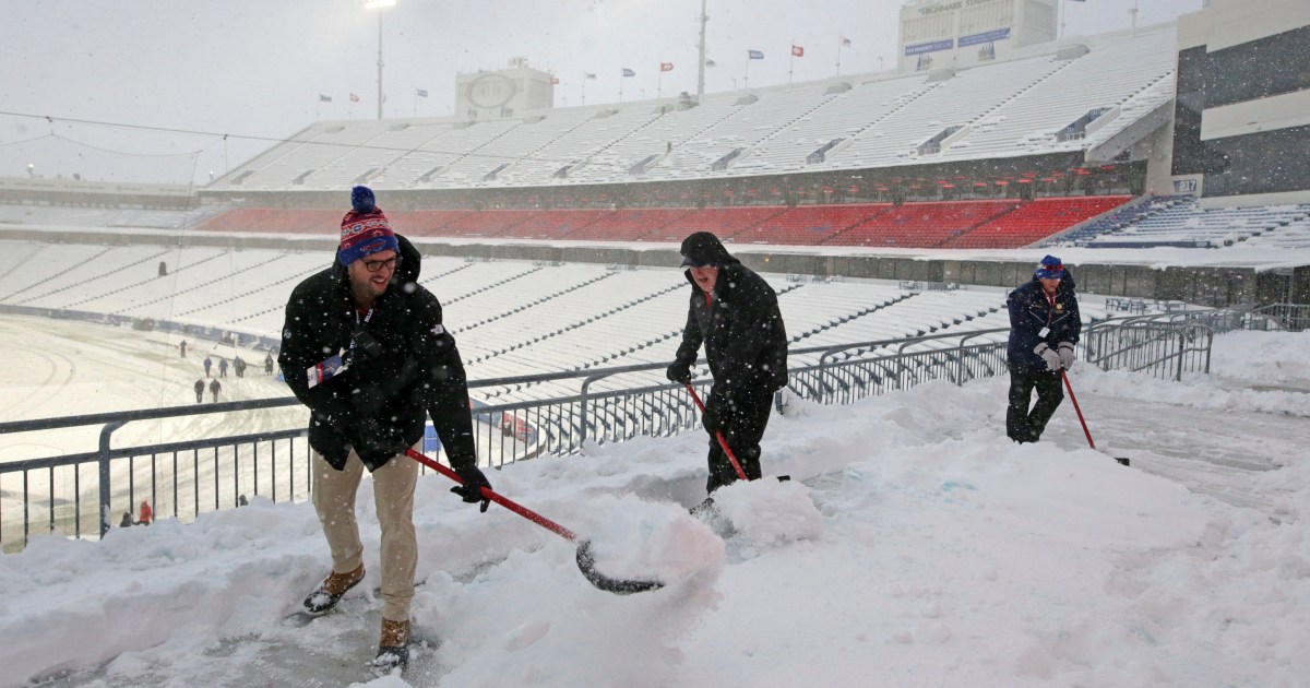
Workers at Highmark Stadium in Orchard Park, New York, had to clear a thick blanket of snow for fans and players as the Buffalo Bills hosted the Miami Dolphins on Saturday evening.
Bills fans in Santa Claus costumes more than endured; they celebrated the winter scenery at their home venue. “Buffalo Bills fans are just built different,” tweeted on-air DJ Josh Grosvent of KROCK radio in Utica and Syracuse.
On Friday, New York Gov. Kathy Hochul called the storm, which was forecast to bring as much as a half-foot of snow to parts of the state, the first nor’easter of the winter storm season. She assured residents 1,732 large- and medium-duty plow trucks were ready.
Pennsylvania state troopers said Friday they had recorded 83 collisions and 38 disabled vehicles as a result of the storm.
As the night deepened Saturday, temperatures dove below freezing even in areas below the Mason-Dixon Line, with even colder weather en route.
Brittany Kubicko and Kurt Chirbas contributed.
Share your story or advertise with us: Whatsapp: +2347068606071 Email: info@newspotng.com


